

Type of trek : easy
Duration of day :3-5 days
Duration a day walking:5-6 hours
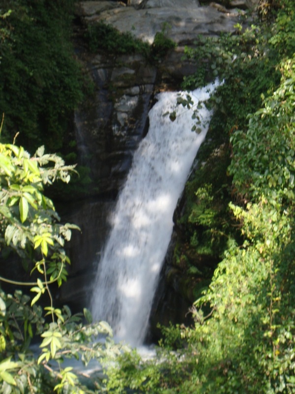
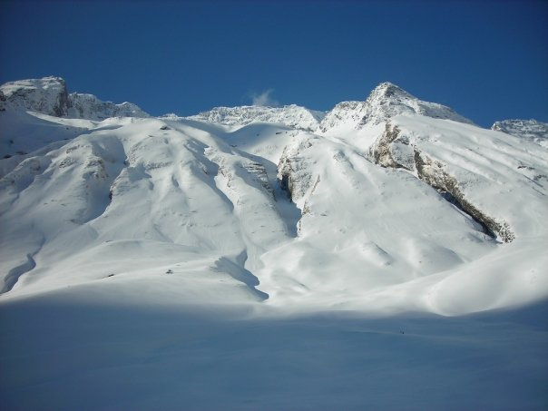
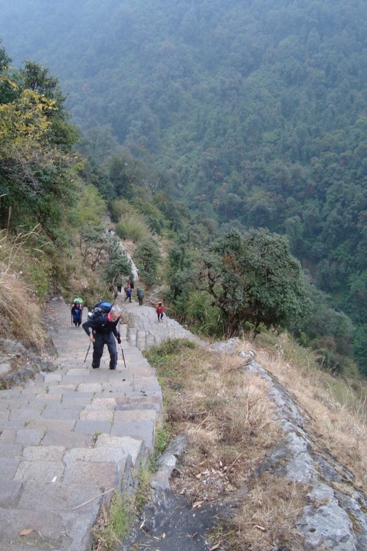
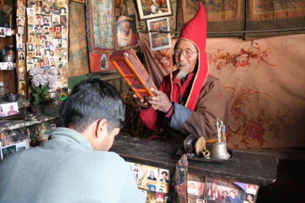
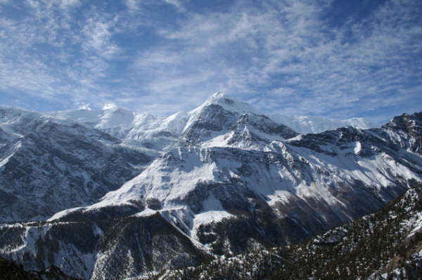
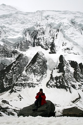
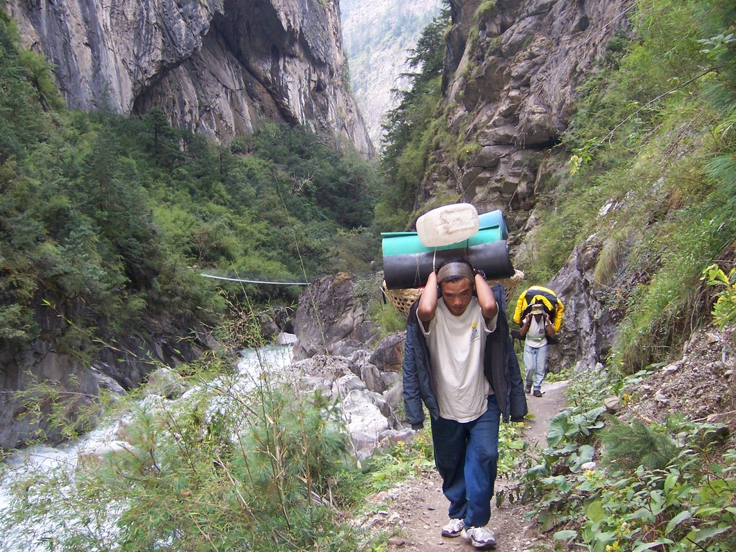
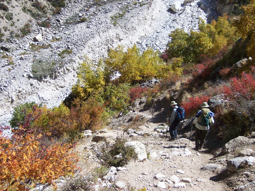
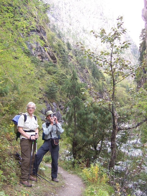
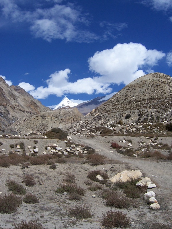
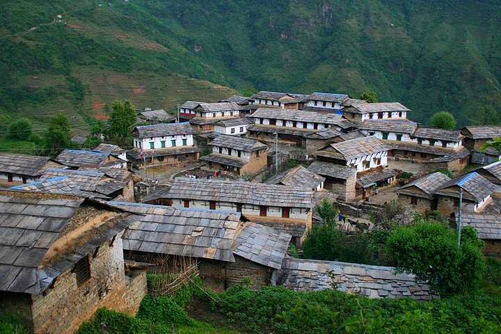
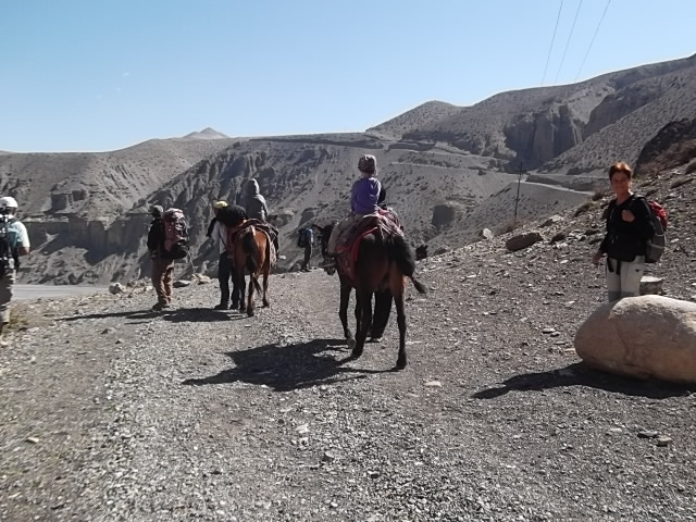
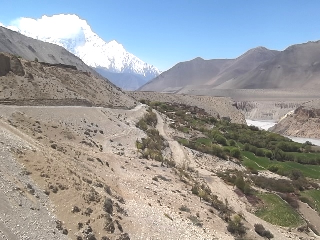
Ghorepani poonhill or Ghorepani-Ghandruk trekking in Nepal, one of the most famous trekking area in Annapurna region. It starts from Pokhara. There are rarely a few places in the world with such a splendid variety of natural beauty as that of Annapurna region. It is a rare combination of long arrays of snow capped, mountains, turbulence rivers with deep gorges, Buddhist monasteries, home of famous Gorkha soldiers and other friendly ethnic groups, as well as hot springs and beautiful Gurung and Magar villages. You can see the whole Annapurna and Dhaulagiri panorama view from Poonhill. This trek is easy one and famous for the short trekkers. In this small circuit trek you can see the different view same peak of the mountain from different place. Which is main attraction of this trekking.
Itinerary:
(Please Note: If the Below schedule does not meet your need and interest, I can design individualized travel plans based on your preferences.
Day 01: About hour of drive from Pokhara(915m) to Nayapul(1050m) on private or tourist vechicle. Trek starts from Nayapul you will reach Ulleri (1750M),final destination of the day Via Birethanti (1065m.) it takes about six hours. The first part of day trek is easy passing through several small villages and settlements. After some gentle ascend you can reach Tikhedhunga and from Tikhedhunga, you have to fully ascend gently in Ulleri(207m). The majority of people in this region are Gurung and they are Buddhist.
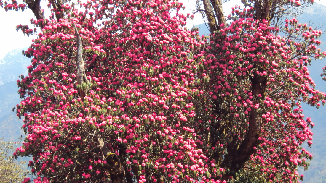
Day 02: Trek from Ulleri to Ghorepani at the altitude of (2870 m.) It takes around six hours. One can see beautiful view of Machhapuchhare or Fish Tail (6993m.), Hiunchuli (6441m.), and Annapurna south (7219m) on the way to Ghorepani. Final hours of today's trail are quite easier passing through rhododendron and shadowy trees and descends gently up to the final camp. Languor and different species of birds are common things to see.
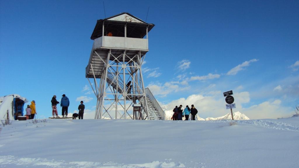
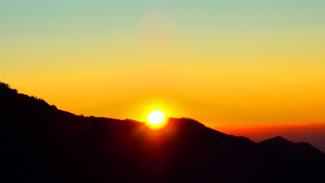
Day 03: Morning hike to the top of Poon Hill(3210m) for the best view of sunrise on Mt. Dhaulagiri (8167m.), Tukuche Peak (6920m.), Nilgiri (6940m.), Varaha Shikhar (7847m.), Mt. Annapurna I (8091m.), Annapurna South (7219m.), Annapurna III (7555m.), Machhapuchhare (6993m.), Annapurna IV (7525m.), Annapurna II (7939m.), Lamjung Himal (6939m.) and other numerous snow capped mountains Descend back to Ghorepani and after having breakfast we will continue our five hour journey unto Tadapani (2650m).
Day 04: Trek from Tadapani (2650m.) to Ghankdruk(1900m) which takes 3 hours.The day trek is very easy by mostly descending gently all the way through Rhododendron, Oak and Sal's dense forests.When you will be Ghandruk
Day 5: Trek from Ghandruk to Nayapul have fully decent until Saulibazar around 3 hours and walk to flat off road around 2 hours to catch the transport for pokhara. Ghandruk to Nayapul and by Car to Pokhara. You are walking through the shadow of the Fish Tail and Annapurna range is heading to the South West ridge of the hills, furthermore down to the Modi Khola. The trails continue through the bank of the Modi Khola and reach the point (Birethanti) where your trek started 5 days ago, possibly lunch here. Half hour walks lead you to catch the transport and then drive to Pokhara
 |
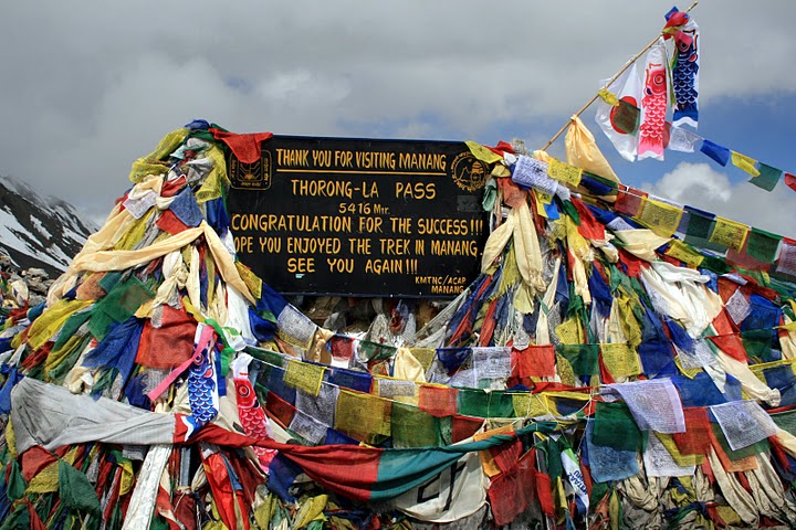
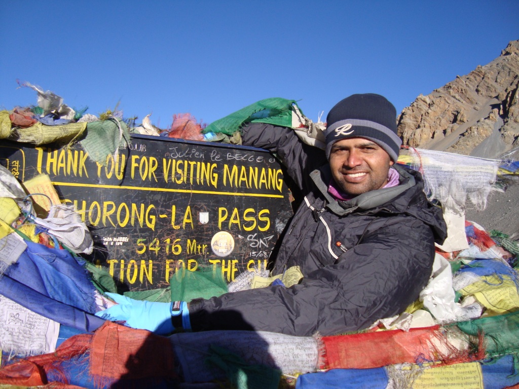
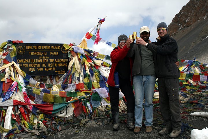
| Throng-la pass |
(Note: If you have minimum 3 days also can this trek: This is normal itinerary:-Ghankdruk-Ghorepani-Nayapul)
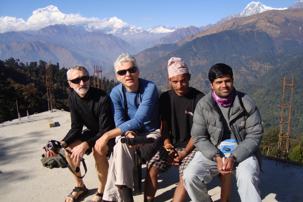
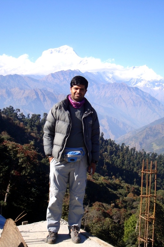
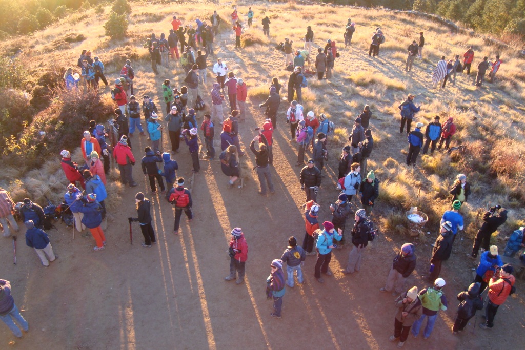
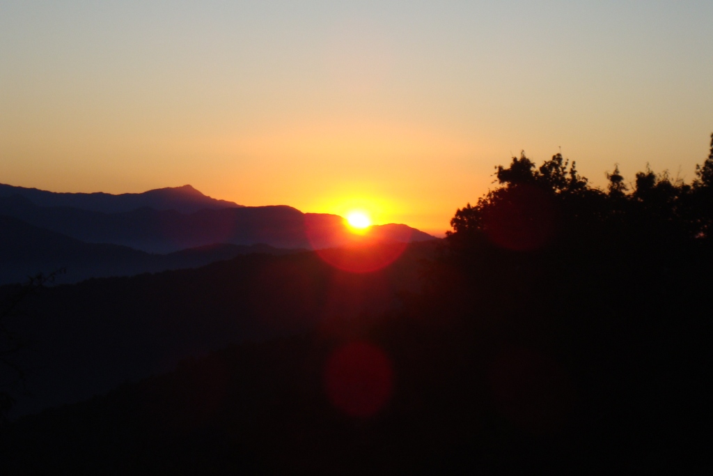
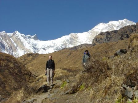
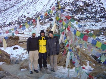
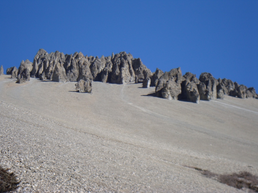
Photos gallery of Ghorepani(Poonhill-3210m)-Ghandruk trek:


Annapurana base camp trekking in Nepal : ABC trek, Annapurana santury trek,
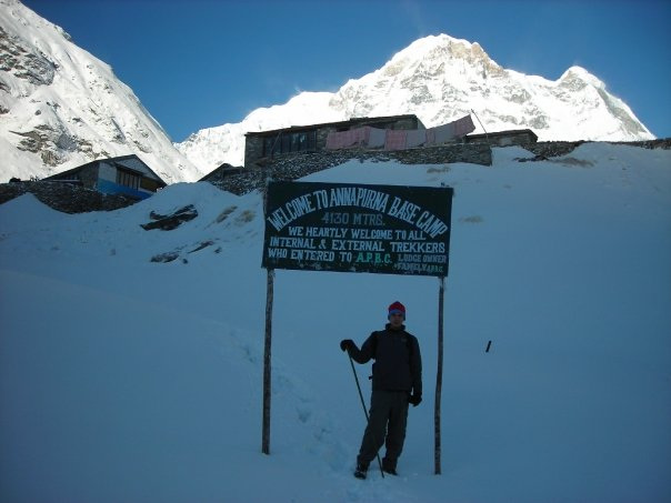
Max.elevation : 4130m
Type of trek : easy+Moderate
Duration of day :7-12 days
Duration a day walking: 5 -7 hours per day
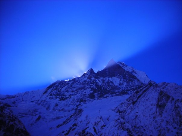
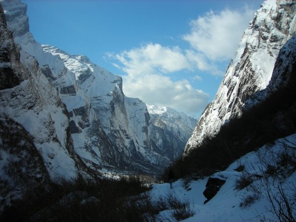
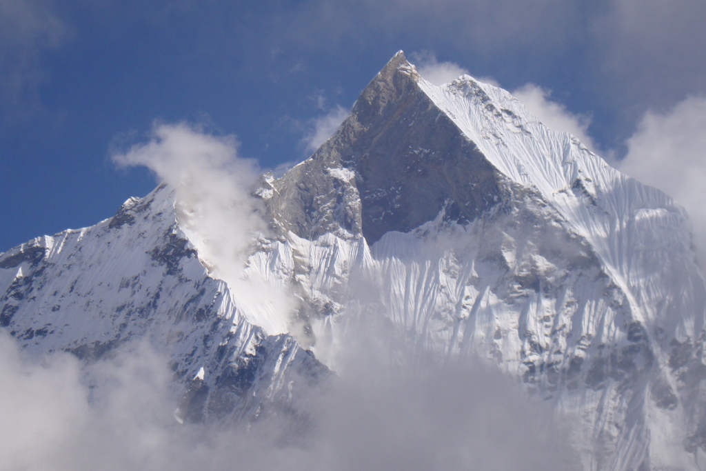
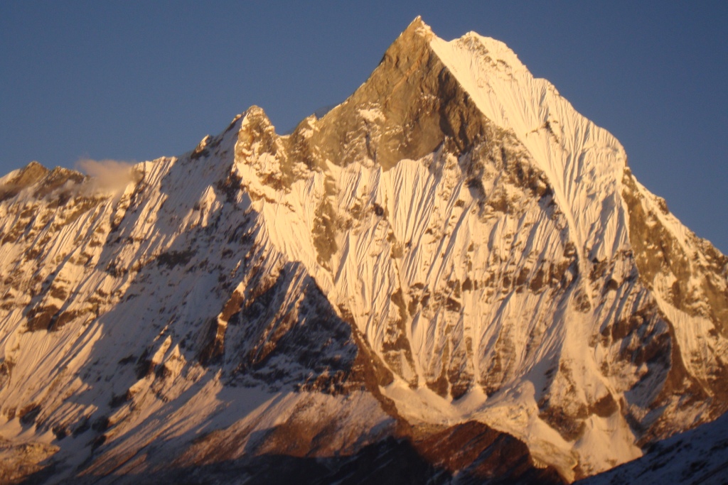
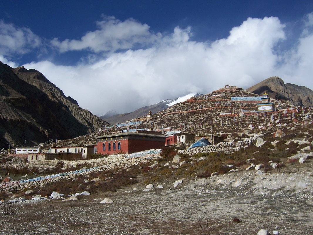
Annapurna base camp trekking in Nepal - The diverse terrain and variety of cultures of the region north of Pokhara make each day's walk a different experience and make the area the most popular destination in the country. Four favorite treks, each with minimum of about one week and maximum of three week treks, to Kali-Gandaki basin include Manang region, Annapurna range, Jomsom and the Annapurna Sanctuary. Alpine meadows, moraines, glaciers and breathtaking views of the Annapurna range abound. The three hundred kilometer Annapurna Circuit combines the first two areas by crossing high altitude pass, Manang Thorang-La (5360 meters) and takes up to three weeks to complete. Part of the range forms a natural amphitheater known as the Sanctuary, ringed by Annapurna I, Glacier Dome, Gangapurna, and the fishtail - shaped peak of Machhapuchhre. This is a fairl strenuous alpine trek, whose aim is to enable the more active walker to quickly get up to snowline not far above our camp. In the Sanctuary, there are opportunities to scramble on ice and snow, and to make an excursion to Rakshi Peak. This trek main attraction is flora and fauna, after the Chomorang you face green hill, forest and wild nature all the way to base camp. When you will reach in the base camp you are around the seven peaks of the snow mountain. At that time it shows you and gives you the feeling that you are in the heaven which will be unforgettable in your life.
Itinerary:
(Please Note: If the above schedule does not meet your need and interest, I can design individualized travel plans based on your preferences.)
6 night/7 night annapurana base camp trekking itinerary,
Annapurna base camp trek, ABC Trek, The guide for ABC, Trek guide Nepal, Trek guide from pokhara, Best trekking in Nepal, Trek in Annapurna base camp, Trek with guide , Trek guide in Nepal, Professional trek guide
Annapurna base camp 9 night/10 days
Length :- approx. 180 KM
Max.elevation : 4130m
Type of trek : easy+Moderate
Duration of day :7-12days
Duration a day walking:5-6 hours
Day 01: About one and half hour of drive from Pokhara(915m) to Nayapul(1050m) on private or tourist vechicle. Trek starts from Nayapul, via Birethanti (1065m.) it takes total about five hours and 9 Km. The first part of day trek is easy passing through several small villages and settlements. After some gentle ascend you can reach Tikhedhunga(1480m) . The majority of people in this region are Gurung and they are Buddhist. From Tikhedhunga, you have to cross the 2 hanging bridge and fully climbed until Ulleri (around one and half hours from Tikhedhunga). In Ulleri mainly Magar (one kind of indigenous or ethnic groups in Nepal) peoples are living and they are Buddhist. Our overnight stay in Ulleri (1900m).
Day 02: Trek from Ulleri to Ghorepani (2850 m.) It takes around five to six hours and 8 Km. Ascending gently through Ulleri big village (1900m.) and we can see mountains Annapurna south(7219m) and Himchuli (6441m) from Ulleri. Still continue gently ascending, we will be reach in Banthati where is we can see beautiful view of Machhapuchhare or Fish Tail (6993m.), Himchuli (6441m.), and Annapurna south (7219m) on the way to Ghorepani. Final hours of today's trail are quite easier passing through rhododendron,oaks and shadowy trees and descends gently up to the final camp. Languor and different species of birds are common things to see.
Our overnight stay in Ghorpani (2850m).
Day 03: Morning hike to the top of Poon Hill(3210m) for the best view of sunrise on Mt. Dhaulagiri (8167m.), Tukuche Peak (6920m.), Nilgiri (6940m.), Varaha Shikhar (7847m.), Annapurna South (7219m.), Annapurna III (7555m.), Machhapuchhare (6993m.), Annapurna IV (7525m.), Annapurna II (7939m.), Lamjung Himal (6939m.) and other numerous snow capped mountains Descend back to Ghorepani and after having breakfast we will continue our five hour journey unto Tadapani (2650m) and 8 Km total. Our overnight stay in Tadapani (2650m).
Day 04: Trek from Tadapani (2650m.) to Chomrong(2170m) which takes five hours and 11 Km.The day trek is very easy by mostly descending gently all the way through Rhododendron, Oak and Sal's dense forests. Kimrung Khola area is richly habited by different species of birds. Ascend steeply and walk at a level for 45 minutes and mostly flat trail with gentle descend. Our overnight stay in Chomrong(2170m).
Day 05: From Chomrong to Himalaya (2900m), It takes around 8 hours and total 10 Km. The trail descends by a stone staircase for first 45 minutes crosses the Chomrong Khola via suspension bridge. High above the west bank of Modi Khola, the trail passes through the forests of Bamboo, Rhododendron and Oaks. Climbing further on a rocky trail and you reach at Sinuwa, at 2350m. You trek gently through the forest and descend a long steep stone staircase till Bamboo. And from Bamboo, you have to gently ascending inside the forest around 1 hours to reach in Dovan and from Dovan takes 2 hours to reach Himalaya(2900m) You have to pass through muddy trail.. Our overnight stay in Himalaya.
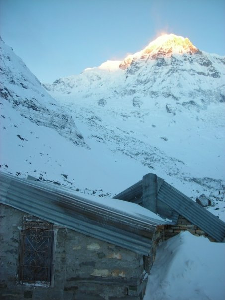
Day 06: Trek from Himalaya to Annapurna base camp It takes about six hours and around 8 Km. There is debris of avalanches during winter season, the trail is steep ascent up to Hinko Cave (3160m.), this named as a huge overhanging rock provides some protection against rain and avalanches then you will reach MBC(3700m). From MBC takes 2 hours for .Annapurna Base Camp (4130m.) The valley widens and becomes less steep and you can see the gates to the sanctuary from here. Enjoy the view of Mount Hiuchuli (6441m.), Annapurna South (7219m.), Annapurna I (8091m.), Annapurna III (7555m.), Gangapurna (7454m.) and Machhapuchhare or Fish Tail (6993m.). Our overnight stay in ABC (4130m).
Day 07: Have breakfast in ABC with panorama view of Himalaya and trek to Bamboo (2310m): It takes about six hours and around 11 Km. It's much easier going down. You should have no problem reaching Sinuwa from Annapurna Base Camp in a single day however we have chosen this Bamboo (2310m) as some of trekkers may have problem on going down. Our overnight stay in Bamboo.
Day 08: Trek from Bamboo to Jhinu danda(1780m) which will take 4 hours and 8.5 Km. The path ascends up to Bamboo Kuldighar passing through forests mostly inherited by Bamboos. After Kuldighar, the trail goes steeply down for hour is quite flat until Sinuwa. Your trek gradually descends to the Chhumrong Khola and following stone staircase before last part of the trail steeply down to Jhinudanda. From the town you should walk down for 20 minutes to reach Hot Spring at the bank of the Modi Khola. You can relax at Hot Spring. Our overnight stay in Jhinu dada (1780m).
Day 09: From Jhinudanda to Australian camp (1900m.) It is a seven hour trek and total 12 Km. The first part of the trek is descent and then appears flat land until Himal Pani. You will find beautiful waterfall here. The trail ascends gently crossing numerous streams and terraces. After short trek, you reach Landruk (1640m.), an appealing big village inhabited by mixed community of Gurung, Magar, Cheetri and Brahmin as well. Now the trail gently ascends to Tolka (1700m.), then goes steeply up to Deurali (2100m.) with a view of different mountain peaks and again trail gradually descends to Pothana passing through different forests. Pothana is a small town resided and from there take half an hour to reach Australian camp, you can enjoy the wonderful views of various mountains from here. Our overnight stay in Australian camp (1900m).
Day 10: Trek from Australian camp to Dhampus Phedi. It takes about three hours to reach Phedi and 5 Km. The Trekking trail is gentle descend up to Dhampus, a village mostly inherited by Gurung Cheetri and Brahmin communities. Then trek through the flat land for several moments and steep downhill unless reaching Phedi. Trekking ends at Dhampus Phedi and drive back to Pokhara by private Vehicles or tourist vehicles. And shopping in evening in Pokhara Lakeside.


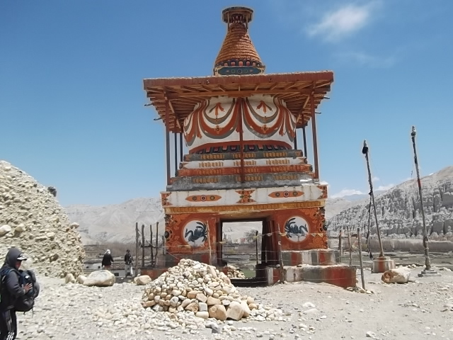
Jomsom muktinath trekking guide in Pokhara, Lower mustang trekking in Nepal,muktinath darshan trekking guide in Nepal , trekwithguide
Max.elevation : 3800m
Type of trek : Easy+Moderate
Duration of day : 5-12days
Duration a day walking:5-6 hours
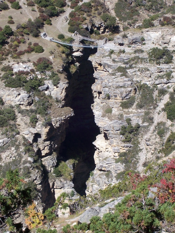
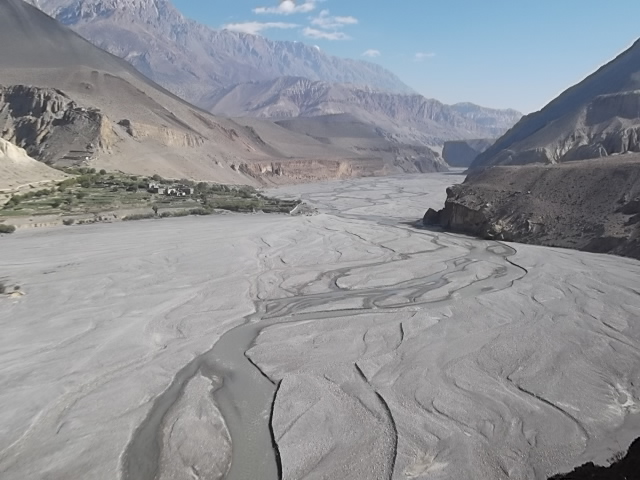
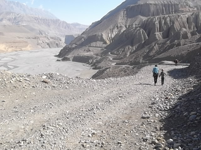
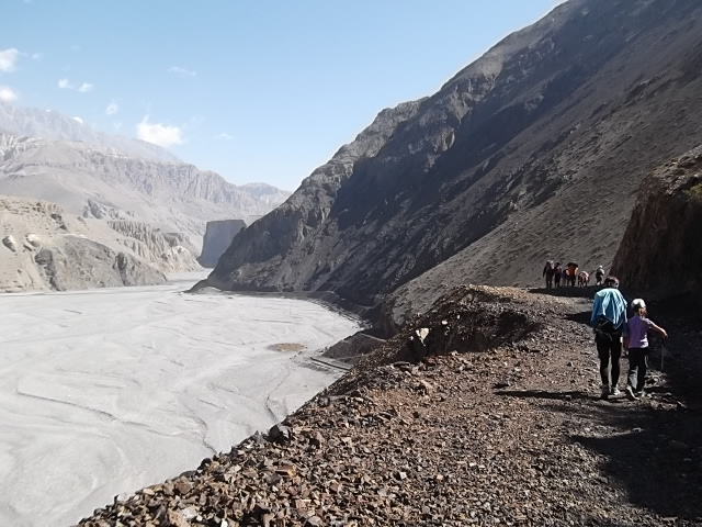
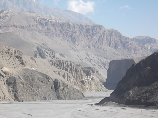
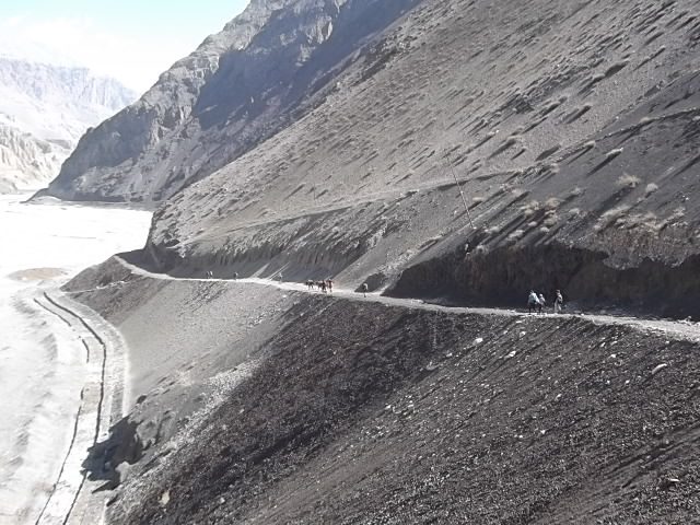
Jomsom-Muktinath trekking in Nepal, Is a part of the Annapurna circuit and perhaps the single most popular trek in Nepal. The diverse landscapes and cultures found along this trekking route give the perfect insight into the rural life of Nepalese people. The main feature of this trek is walking through the gorge carved by the Kali Gandaki River,
The starting and ending point is Nayapul about one hour drive from Pokhara. Normally trekkers continue on above Jomsom to Mukitnath, the famous pilgrimage site for both Hindu and Buddhist. To the Hindu, Muktinath is a sacred as the place of salvation. They believe that to wash in the water here guarantees salvation after death. To the Buddhist it is the place that the great sage Guru Rinpoche (Padmasambhava) meditated at, and to all, it is the source of fossilized ammonites, known locally as shaligrams that are found all along the upper reaches of the Kali Gandaki River valley. This trek is recommended year round as most of this trek is always in the rain shadow.
Itinerary:
Day 01- Arrival in Kathmandu airport (1345meters). There you will be met by our Airport Representative and transferred to hotel by private tourist vehicle. Overnight at your hotel with breakfast included.
Day 02- Sightseeing around Kathmandu valley.Your sightseeing trip will start at 9 AM in the morning after breakfast. You will be provided a private vehicle and professional tour guide. We visit Pasupatinath temple, Buddhanath, Monkey temple, Bhaktpur durbar square and Kathmandu durbar square. The afternoon includes a final briefing and preparations for the trek. Overnight at hotel.
Day 03- Drive to Pokhara (900 meters) 7 hours by tourist bus. Trekking staff will come to your Hotel at 6.30am in the morning to pick you up, 7 hour driving journey to Pokhara. Overnight at hotel.
Day 04- Drive to Nayapul (1010meters) and trek to Tikhedunga (1570meters) 3 hours We begin our trek at Nayapul after 1 hour driving by
private vehicle from Pokhara. After 15 minutes a short walk along the banks of the Modi Khola, we reach Birethanti (1015meters) a large village that has many shops and teahouses. From there, the trail continues through the village. The trail follows the north bank of the Bhurungdi Khola. Then the trail climbs steadily up the side of the valley to Hille at 1495m and after the short climb, we reach Tikhedhunga at 1570meters. Today’s walk offers a short and relatively easy day, during the journey which allows us to become used to the experience of trekking in Nepal. Overnight at guesthouse.
Day 05- Trek to Ghorepani (2840meters) 5 hours.Leaving Tikhedunga, we begin our journey with a steep climb to Ulleri. Ulleri is a large Magar village at 2070meters. The trail then continues to ascend more gently, through fine forests of oak and rhododendrons towards Banthanti at 2250meters. We trek towards Nangethanti at 2460m. After an hour of walk this brings you to Ghorepani at 2840meters. Overnight at guesthouse.
Day 06- Hike up to Poon Hill (3210meters) and trek to Tatopani (1190meters). 6 hours. It’s an early morning rise at 5 o’clock; we begin
trekking for Poon Hill. It takes an hour to climb from Ghorepani to Poon Hill, presenting you with one of the best Himalayan viewpoints in Nepal from where spectacular Himalayan ranges with amazing sunrise views can be seen very closely.
After observing the wonderful Himalaya views, we return to Ghorepani to have a hot breakfast. After breakfast, we continue our journey to
Tatopani.
The trail makes a steep descent to Chitre at 2390m. As the trail drops down through Sikha, the hills are extensively terraced. Sikha is a large
village with shops and hotels at 1980m, from there the trail descends gently to Ghara at 1705m. A further steep descent of 500m takes you to the Ghar Khola where the trail crosses the river on a suspension bridge. We then climb up above the Kaligandaki River before crossing too.
As you turn north, it takes you to the Tatopani at 1180m. Tato means ‘hot’ and pani is ‘water’, a name earned courtesy of the hot springs by the river. Tatopani is a popular short trekking spot just out of Pokhara. Overnight at guesthouse.
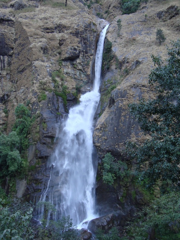
Day 07- Trek to Ghasa (2010 meters) 5 hours. Today, the trail climbs up the Kali Gandaki gorge, considered to be the deepest in the world which is situated between the two 8000meters peaks of Annapurna and Dhaulagiri. The trail rises gently up to Dana at 1400meters, and onto Rupse Chhahara at 1550meters, there you can see a stunning waterfall. As the trail crosses to the eastern bank of the river, you will reach Kopchepani which crosses back to the western side on a suspension bridge at 1935meters. Then a short climb to Ghasa at 2010meters. Overnight at
guesthouse.
Day 08- Trek to Tukche (2586m.) 5.30 hours. We start the trek by crossing to the eastern side of the river, but cross back again further up the
trail before entering Larjung at 2560meters. The trail continues on a short distance to the interesting village of Khobang with its narrow alleyways. Then we spend over night at the ancient Thakali village of Tukuche at 2590meters. Overnight at guesthouse.
Day 09- Trek to Kagbeni(2810m.) 5 hours. From Tukche, we climb along the side of the valley to Jomsom at 2713meters. Jomsom is
a large, bustling settlement and it’s the administrative centre to the region that contains the airport, army camp, hotels, shops, banks and government offices.
We cross the river to the eastern bank; then walk towards Eklai Bhatti at 2730meters. From here we take a direct route to Muktinath that ascends the hill behind the village, however we follow the trail along the river to Kagbeni at 2810meters which is situated at the junction of the Jhong Khola & the Kali Gandaki which is the northern most village that can be visited without a permit to continue on to Mustang. This village is fascinating with its rich Tibetan cultures and their unique hospitality which influences us greatly. Overnight at guesthouse.
Day 10- Trek to Muktinath (3802meters) 5 hours. We make a steep climb up the Jhong Khola valley leaving Kagbeni, we then join the direct trail to Muktinath just below Khingar at 3200meters. From here trail continues high above the Jhong Khola to the imposing village of Jharkot at
3500meters, well worth exploring. We take a break here for lunch before continuing on to Muktinath .As we leave Jharkot, the trail climbs up to our ultimate destination of Muktinath at 3802meters. We initially visit Ranipauwa, there are many teahouses and shops. Our overnight stay will be here. Further 10 minutes’ walks up the hill, we will be rewarded with the actual religious site of Muktinath & this area is kept free of hotels and camping sites. Muktinath is a pilgrimage center for Buddhists and Hindus. There we can see Tibetan traders as well as sadhus from the far south of India. There are shrines in a grove of trees including a Buddhists gompa & the Vishnu temple of Jwalamai. An old temple nearby shelters a spring and natural gas jets that provide Muktinath’s famous eternal flame. It’s the earth-water- fire combination that accounts for Muktinath’s great religious significance. Overnight at guesthouse.
Day 11- Trek back to Jomsom (2713meters) 5 hours. Today we follow the same trail nearby Kagbeni and then the new trek takes you down to the Eklebhatti, then again follow same trail to Jomsom. Overnight at guesthouse.
Day 12- Morning flight to Pokhara.Today 30 minutes morning flight takes us to Pokhara from Jomsom. Once we arrived at Pokhara airport, we then drive to hotel. In the afternoon we will have a sightseeing tour around Pokhara valley, which covers Fewa Lake, Devi’s water fall, Museum, Tibetan refugee settlement and Gupteshower cave etc. Overnight back at hotel.
Day 13- Leisure day and Sightseeing in around Pokhara. It's also spare day in case of bad weather in Jomsom. Overnight at hotel.
Day 14- Drive back to Kathmandu (1345meters) by bus or flight


Classic trek on ancient trade routes - Ascending the Marshyangdi valley - Passing Manaslu and Hinchuli - Visit old Buddhist monastery in Braga - Explore beautiful Manag village - Crossing the Thorung- La ( 5416m) - The Pilgrimage town of Muktinath, View of Dhawagiri Ice- flow - The world deepest gorge and the Kaligandaki valley - Natural Hotspring at Tatopani - Sunrise at Poonhill with magnificent mountain views.
Type of trek : Moderate+challange
Duration of day :12-21days
Duration a day walking:3-8 hours
This is one of the classic and most regarding treks. The trek starts from the lowlands and gradually passes through thick forest adorned with rhododendron and fir trees as we enter into the desert region of our way to the Manag valley. This trek offers classic view of the Annapurna Range and the Dhaulagiri Range. Besides the mountain views there is a lot of diverse culture to be seen as we start from the domains of Brahmins and Chhetris in the lowlands to the culture of the Managis people who have a distinct culture of their own and are mainly Buddhists. The views from the Thorang Pass of the Himalayas and into the Mustang valley are outstanding.
Itinerary :
(Please Note: If the above schedule does not meet your need and interest, I can design individualized travel plans based on your preferences.)
Day 01: Your arrival to Tribhuwan International Airport (TIA) Green Valley Nepal Treks airport representative well come to pick up you at Kathmandu International Airport then transfer to your Hotel. At evening we discuses about Annapurna Circuit Trek then we offer you well come dinner in Traditional Nepali restaurant.
Day 02: Drive Kathmandu to Besisahar 790m. Drive from Kathmandu to Besisahar takes about 6-7 hours with local bus or by private couch because there isn’t tourist bus. At evening you could have a walk around Besisahar. Besisahar is center of Lamjung district.
Day 03: Besishahar to Bahundanda (1310m). Annapurna Circuit Trek starts from Besishahar, the trail makes ascend to Khudi Village at 790m, then reach the first Gurung village as we continue from Khudi the trail offers fine views of Himalchuli and Peak 29 (Ngadi Chuli). Trekking trail continues ascends to Bhulbhule at 825m. Its goes through Ngadi, Lampata at 1135m and Bahundanda at 1310m.
Day 04: Bahundanda to Chyamje (1400m). Today the trail drops sharply to Syange at 1070m from Bahundanda crossing the Marsyangdi River on a suspension bridge. We then follow the river to the stone village of Jagat before climbing
through forest to Chyamje at 1400m.Overnight at Guest House.
Day 05: Chyamje to Bagarchhap (2160m). The day begins with the rocky trail following the Marsyandi Rivers progressively uphill to Tal at 1675m, the first village in the Manang district. We make a trail poetry crossing a extensive, flat valley. The trail then ascends a stone staircase to 1860m till another stairway. The journey continues making up and down to Dharapani at 1890m. There we find a stone entrance chorten typical of the Tibetan prejudiced villages from here northwards. We then visit the Bagarchhap at 2160m that offers the typical flat covered stone houses of local Tibetans design although the village which is still in the conversion Zone before the dry highlands. Overnight at Guest House.
Day 06: Bagarchhap to Chame (2630m). With often rough and rocky, the trail climbs to Timang at 2360m, then continues through forest, but near the river, to Kopar at 2590m. As we get to the Chame, the headquarters of the Manang district, we are satisfied by the fine views of Annapurna II as you approach Chame & two small hot springs by the town. Overnight at Guest House.
Day 07: Chame to Pisang (3300m). The day starts through deep forest in a steep and narrow valley, crosses a river on a long bridge at 2910m. We then cross another bridge at 3040m, from there the view of the towering Paungda Danda rock face really begins to appear. From there the trail joins to climb to Pisang, 3200m.Overnight at Guest House.
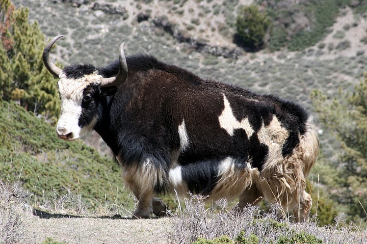
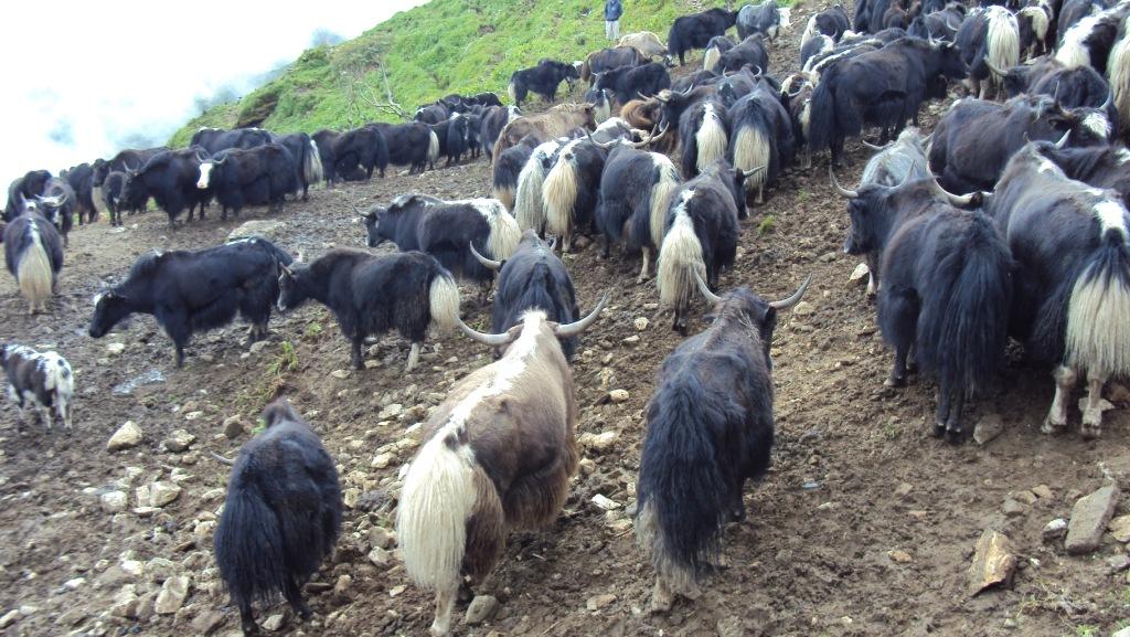
Day 08: Pisang to Manang (3500m). Today we continue through the upper part of the Manang district, the full effect of the monsoon by the Annapurna Range. People of this region, herd yaks & raise crops for part of the year in addition, they also continue to enjoy special trading rights gained way back in 1784.Leaving Pisang, we have an alternate trails north and south of the Marsyangdi River which meet up again at Mungji. The southern route by Hongde, with its airstrip, at 3325m involves less climbing than the northern route via Ghyaru, though there are better views on the trail that follows the northern bank of the river. From Mungji, the trail continues past the picturesque but partially hidden village of Bryanga at 3475m to nearby Manang at 3500m.Overnight at Guest House.
Day 09: Manang Rest Acclimatization day Today we spend a day acclimatizing in Manang. The whole day we spend by doing some fine day walks and over viewing the wonderful views around the village & the day time is best to gain altitude. At the end of the day, we return back to our accommodation & have a night rest. Overnight at Guest House.
Day 10: Manang to Ledar (4250m). Today we leave Manang, & the trail makes an ascent of nearly 2000m to the Thorung La pass. We make the ascend progressively through Tenki, leaving the Marsyangi Valley. Continuing along the Jarsang Khola Valley, we reach Ledar at 4250m.Overnight at Guest House.
Day 11: Ledar to Phedi or High camp (4600m). The trail descends to cross the river at 4310m we then ascend up to Phedi at 4420m. At High Camp on the elevation of 4600m, we can recently found some good Guesthouses built. Your overnight stay will be there. Overnight at Guest House.
Day 12: Phedi or High Camp to Muktinath (3710m). The journey from Phedi "foot of the hill" or at the foot to the 5416m Thorung La pass, starts the day. We then make the climb steeply that is regularly used and easy to follow. However, the problem may occur due to the altitude and snow. It often causes terrible problem to cross the pass if it is covered by snow. About four hours climb up to the pass marked by the chortens & prayer flags. As you reach the top, you are rewarded by the magnificent view from the top. Overnight at Guest House.
Look at jomsom trek itinary after this :
Day 13: Trek to Jomsom (2713m.). Treks ends here. Overnight at Guest House.
Day 14: Fly back to Pokhara (about 20 minute's short, but scenic flight). Overnight at hotel.
Day 15: Drive back to Kathmandu by Toursit Bus - about 6-7 hours scenic drive.
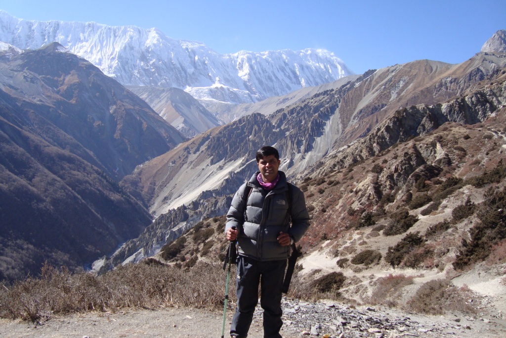
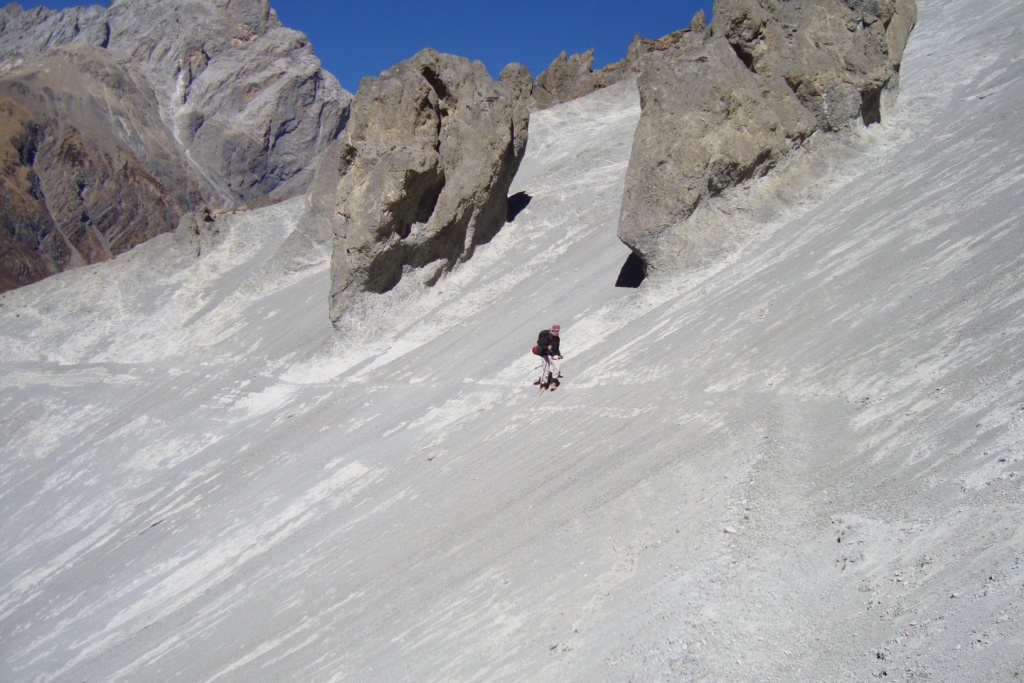
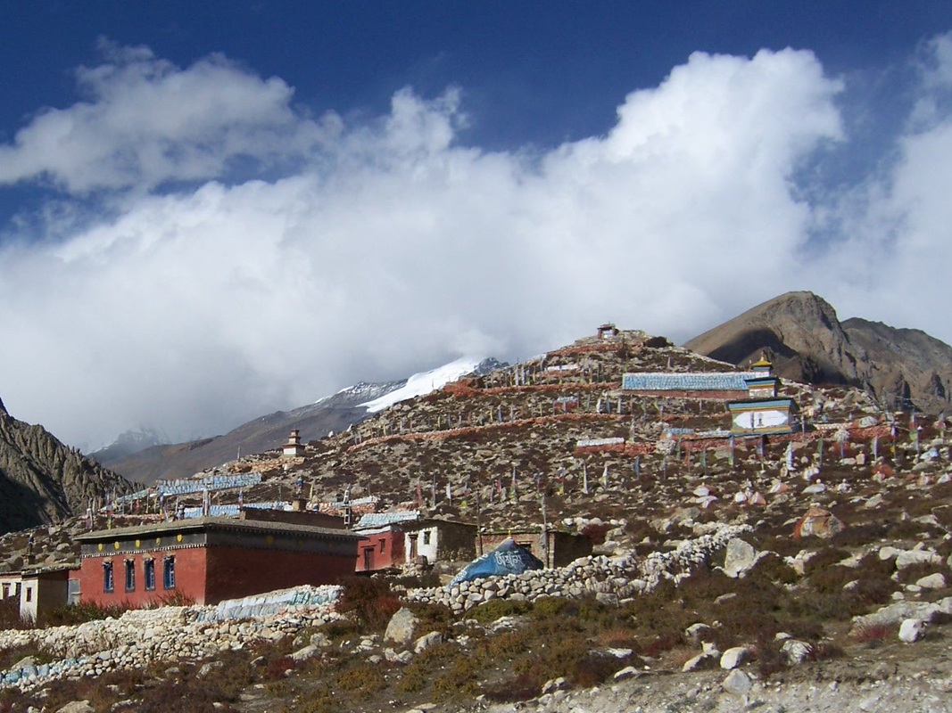
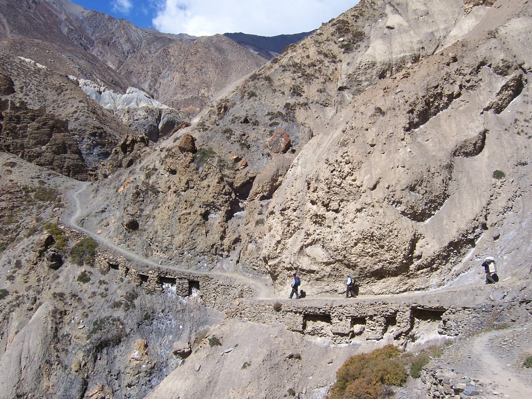
photos gallery of Annapurna circuit trek :
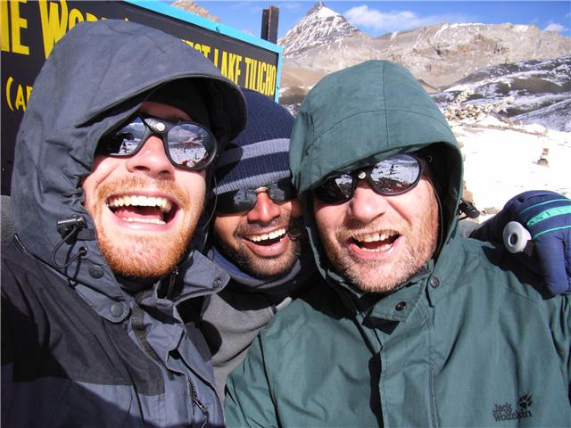
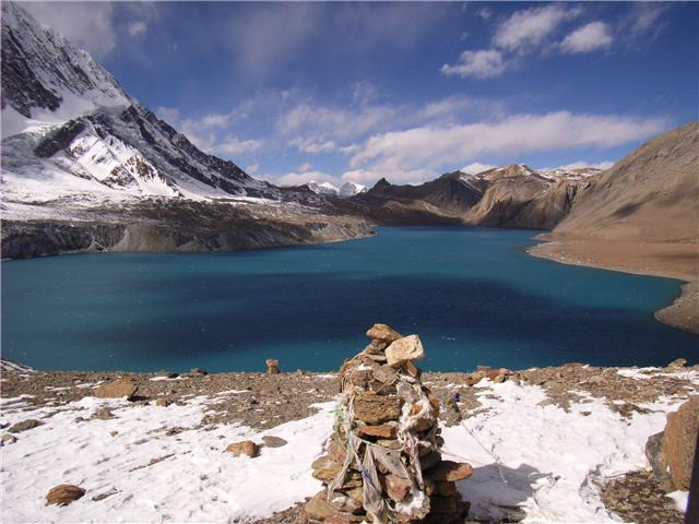
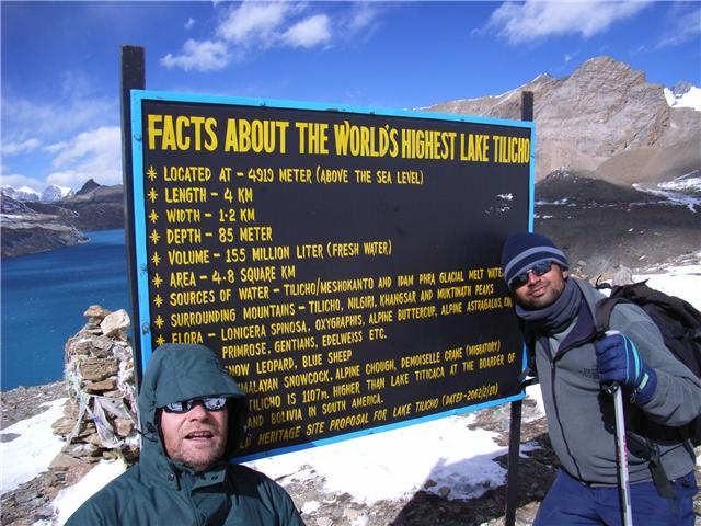
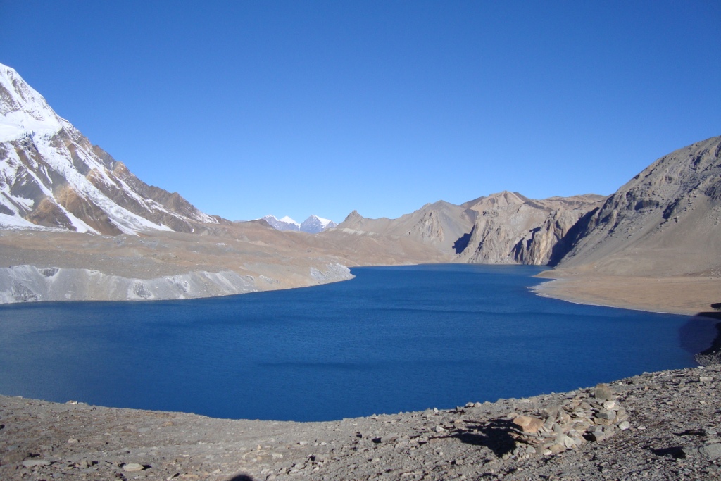
Tilicho Lake Trek (world
highest place's lake) About Tilicho lake, Tilicho lake trek guide, Guide for Tilicho Lake, World highest place's lake
Max.elevation : 5416m
Type of trek : Moderate+challange
Duration of day :12-21days
Duration a day walking:3-8 hours
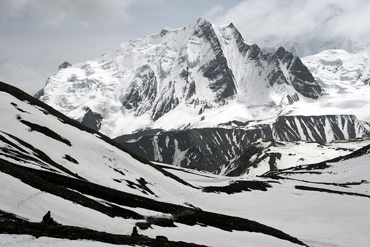
World Highest Place Lake-- Tilicho Lake 5200 meters collects the glacial melt of the entire northern slopes of Annapurna and Thorong Peak it is claimed to be the highest lake in the world. In 2001, Hindu pilgrims from around the world flocked to the lake convinced it is a holy spot mentioned in the Ramayan – a holy book of the Hindus.
This trek starts right from Besisahar which goes along the Marshyangdi River, with great views of Manaslu and Himal Chuli to the east. This magnificent trek leads you to the fine village inhabited by a wide diversity of people from different ethnic groups, offering spectacular and majestic views of the white Himalayas. We have customized this route as it is basically the same as Annapurna Circuit, from Manang instead of
taking the valley north to Tanki Manang and Yak Kharka this route goes to the main valley to the west passes through the Khanshar Village (The Last Village of Nepal) and trek up to Tilicho lake, then we travel to Yak Kharka then up to pass of Thorung La at elevation of 5416 meters. From the pass of Thorung La the treks lead down to Muktinath then to Jomsom from where thirty five minutes scenic flights take you to the Pokhara.From Tilicho Lake you also have the option of crossing the challenging pass of Moesokanta La Pass to Jomsom instead of traveling to Thorung La pass but good additional equipments with tented camp are require to go through this pass.
(Please Note: If the Below schedule does not meet your need and interest, I can design individualized travel plans based on your preferences.)
Itinerary in Details:
Day 01- Drive to Besisahar (830meters) by private transport 4 hours. Trekking staff will arrive at your Hotel at 7.00 am in the morning to pick you up then 4 hours driving journey to Besishar, lunch in Besishar. And next drive by public transport to Bulbule. Overnight at Guesthouse.
Day 02- Trek to Jagat ( 1400m).Today our journey starts from Bulbule, Our first day introduces us to the cultural elements of Nepal; we encounter a typical local house and the different faces of the various people, exchanging greetings Namaste as we pass, the trail drops steeply to Syange at 1070meters from Bahundanda crossing the Marsyangdi River on a suspension bridge. We then follow the river to the stone village of Jagat at 1400meters. It takes total 7 hours.
Day 03- Trek to Dharapani (1860 meters). 6 hours.Our day begins with the rocky trail following the Marsyandi Rivers steadily uphill to Tal at 1700 meters, the first village in the Manang district. We make a trail verse crossing a wide, flat valley. The trail then climbs a stone stairway to 1860 meters till another stairway. The journey continues up and down to Dharapani at 1860 meters. There we find a stone entrance chorten typical of the Tibetan influenced villages from here northwards. Overnight at Guesthouse.
Day 04- Trek to Chame (2630meters). 6-7 hours. After 1 hours, we can reach Bagarchhap at 2160 meters that offers the typical flat roofed stone houses of local Tibetans design although the village which is still in the transition Zone before the dry highlands. The trail climbs to Timang 2270meters, then continuing through forest, but near the river, to Kopar at 2590meters. As we reach the Chame, the headquarters of the Manang district, we are rewarded by the fine views of Annapurna II as you approach Chame & two small hot springs by the town.Along this route we are introduced to a local community said to have migrated from Tibet a long time past, noticeable by their different features. With them, they have bought local Tibetan house designs and maintained their ways. Overnight at Guesthouse.
Day 05- Trek to Upper Pisang (3300 meters) 6 hours.The day starts through deep fine forest in a steep and narrow valley, crosses a river on a long bridge at 2910meters. We then cross another bridge at 3040meters, from there the view of the soaring Paungda Danda rock face really begins to appear. From there the trail joins to climb to Pisang, which sprawls between 3200m & 3300meters.
Day 06- Trek to Nagwal (3700 meters) . it takes around 4 hours ( Upper trails) Overnight at Guesthouse.
Day 07- Trek to Manang (3540 meters). 4-5 hours.Today we continue through the drier upper part of the Manang district, cut off from the full effect of the monsoon by the Annapurna Range. People of this region herd the yaks & raise crops for part of the year. They also continue to enjoy special trading rights gained way back in 1784. Leaving Pisang, we have alternate trails north and south of the Marsyangdi River which meets up again at Mungji. The southern route by Hongde, with its airstrip, at 3325meters which involves less climbing than the northern route via Ghyaru, though there are better views on the trail that follows the northern bank of the river. From Mungji, the trail continues past the picturesque but partially hidden village of Braga at 3475meters to nearby Manang at 3540meters. Overnight at Guesthouse.
Day 08- Acclimatization day at Manang village. Today we spend a day acclimatizing in Manang. The whole day we spend doing some fine day walks and over viewing the magnificent views around the village & the day time is best to gain altitude. At the end of the day, we return back to our accommodation & have a night rest. Overnight at Guesthouse.
Day 09- Trek to Shree kharka (4000m). It takes 4 hours After acclimatized at Manang we continue our adventure for Tilicho Lake, from Manang one heads out through the western gates and then one follows the path down to the river. After crossing the the Khangsar Khola on the bridge below Khangsar and ascend the slope to the village, a village still in the old Tibetan style and which is also known as last village of Nepal.And from that village, Pass a Gompa (monastery), 1.5 hours walk to Shree Kharka. Overnight at Guesthouse.
Day 10- Trekking to Tilicho Base Camp (4200meters) 5 hours.Continue from Shree Kharka, on a large path. The route ahead goes on a recently constructed path up towards a high ridge. At one point is an intersection. One path maintains the altitude,traversing the slopes towards a place where the valley is narrow; the other continues to ascend towards the line of the ridge. The former is the old path, and is much more difficult as it goes on really steep screed; the latter is the new path that goes a completely different way. Continue along the new path, reach a high crest, and descend on switch backs carved out through the screed slopes to a side valley of the main valley. At its bottom is a brook. On the other side of it is a building known as Tilicho Base Camp at elevation of 4200 meters. Overnight at Guesthouse.
Day 11- Trek to Tilicho Lake (5200 meters), it take 3.5 hours and back down to Tilicho Base Camp (4200meters) and have a lunch and continue to Shree Kharka 4 hours. Overnight at Guesthouse.
Today our journey start early in the morning around 4am . as we trying to avoid the wind. From Base camp to the Tilicho lake takes another 3-4 hours. Tilicho Lake is a cold barren place in the afternoon and claimed as highest lake of the world. After we spend some time around Tilicho Lake we will return same way back to Base Camp as there are no any accommodation facilities at Tilicho Lake area.
Day 12- Trek to Yak Kharka (4000 meters) 5 hours Returning from Shree kharka, you can keep high and follow a track so above Khangsar village passing through the ruins of old Khangsar and follow an unmarked trail which will lead you around and down to cross the river on an old log bridge between Gumsang and Yak Kharka. Overnight at Guesthouse.
Day 13- Trek to Thorong Phedi (4450 meters) 5 hours.Today, after ascending for 3.5 hour the trail descends to cross the river at 4310 meters we then climb up to Thorong Phedi at 4450meters where we have recently found some good Guesthouses built. Overnight at Guesthouse.
Day 14- Trek to Muktinath (3800 meters) via Thorung La pass (5416 meters) 8 hours.Today is a long trek starting before sunrise at 4 am to reach the pass by 9-10 am otherwise weather conditions will greatly affect the journey. We cross over at an altitude of 5416 meters we can be exposed to strong winds if crossing too late. We start to climb steeply that is regularly used and easy to follow. However, the problem may arise due to the altitude and snow. It often causes terrible problems to cross the pass if it is covered by snow but it is all depending on the weather condition. About four hours climb up to the pass marked by the chortens & prayer flags. As you reach the top, you are rewarded by the magnificent view from the top with another 4 hours trek will take to the holy town of Muktinath. Overnight at Guesthouse.
Muktinath means place of Nirvana and is home to the Muktinath temple as well as several monasteries. It is said that all sorrows you feel are relieved when visiting the Temple, which is a scared pilgrimage site to both Hindus and Buddhists. The main pilgrimage normally takes place in September. The Temple is dedicated to Lord Vishnu and has 108 waterspouts around it from which Holy water pours. Another attraction nearby is the Jwala Mai Temple this contains a spring and an eternal flame fed by natural underground gas.
Day 15- Trek to Kagbeni through Jhong( avoid the jeep road)-(2800m) Overnight at Guesthouse.
Day 16- Trek to Marpha 2670m. It take around 7 hours .Today, we follow the trail slop down to the Eklebhatti, and then follow the Kaligandaki River to Jomsom. Jomsom is large town with many facilities, it is also headquarter and official town for whole Mustang district where all the government office are available for local people in Mustang. Lunch in Jomsom and continue to walk Marpha from different trekking routes. Overnight at Guesthouse.
Day 17- Trek to Largung(2550m.) . We will walk different sides of jeep road through Chairo (Tibetan settlement) village .Walk a valley dominated by Thakalis, Gurungs and Magars tribes. Overnight at Guesthouse.
Day 18- Trek to Ghasa (2010m) .5 hrs walk, a dramatic change in the surrounding with green vegetation and very beautiful view of Dhaulagiri and Annapurna region. Overnight at Guesthouse.
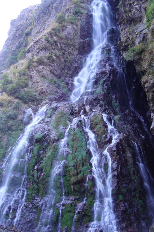
Day 19- Ghasa to Tatopani (1189 m.) 5/6 hours walk, gradual descend to Tatopani through valleys, fields and the beautiful Rupse Chhahara (water falls) and then the time to have lunch at Dana village which is the deepest gorge in the world. Rest and overnight at Tatopani.
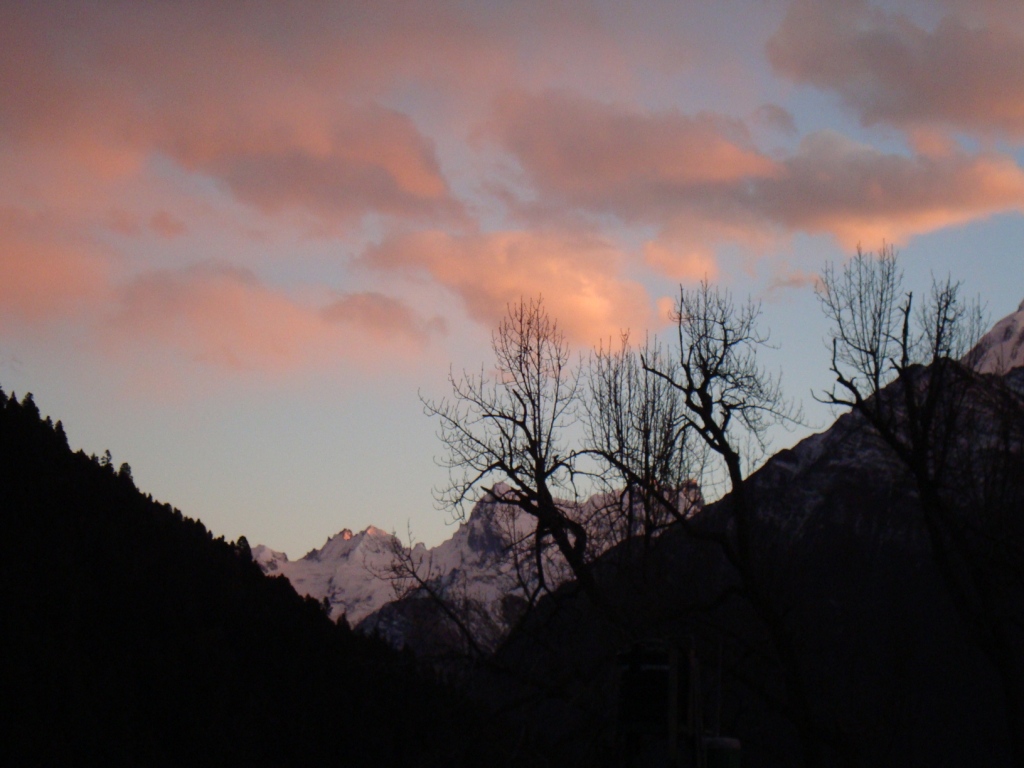
Day 20- Tatopani to Ghorepani (2793 m.) 7/8 hrs. walk, A challenging ascent upto Ghorepani. Lunch at Sikha village, and overnight at Ghorepani from where one can observe the best sun set view over the profile of Mt. Dhaulagiri and Annapurna. Overnight at Guesthouse.
Day 21- Morning hike to the top of Poon Hill(3210m) for the best view of sunrise on Mt. Dhaulagiri (8167m.), Tukuche Peak (6920m.), Nilgiri (6940m.), Varaha Shikhar (7847m.), Annapurna South (7219m.), Annapurna III (7855m.), Machhapuchhare (6993m.), Annapurna IV (7525m.), Annapurna II (7937m.), Lamjung Himal (6931m.) and other numerous snow capped mountains Descend back to Ghorepani and after having breakfast we will continue our five hour journey unto Ulleri (1750m).Overnight at Ulleri.
Day 22-Trek to Nayapul . it takes about 4-5 hours. Today all parts of day trek is easy passing through several small villages and settlements. After some gentle decend, you can reach Birethati and Lunch will be Birethati. After lunch, 30 minutes walk to Nayapul and drive back to Pokhara.
or
Day 18- Morning flight to Pokhara.Today 15 minutes morning flight takes us to Pokhara from Jomsom.
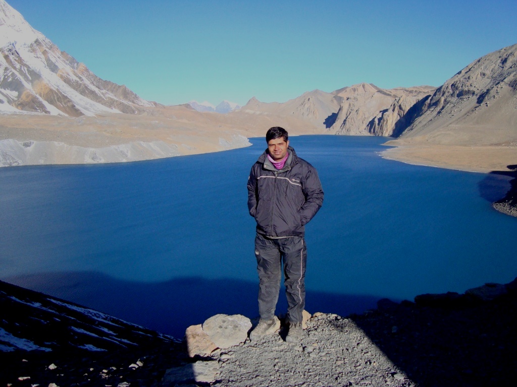
Photos gallery of Tilicho Lake trek:

Max.elevation : 5416m
Type of trek : Moderate+challange(Tea house and camping )
Duration of day :16-21days
Duration a day walking:3-8 hours
Narphu trek is remote valley left untouched by civilizations enter from near Chame, on the trail of popular Annupurna trek. Exploring the valley to the north, visiting Phu village situated on the edge, we travel south to Nar VillageThis is probably the best trek of Annapurna region and for those who want to explore hidden valley and trek off the beaten crossing through Challenging high passes like Masokanto La (5099m), Kangla pass (5200m) & Tilicho Pass (5230m) with beautiful Lake Tilicho. Hidden by swirls of mountain mist ahead of us, from Kangla pass at 5200m the magnificent panorama view of Annapurna massif appears remote and forbidding.Our destination is the Nar-Phu valley, above the tree line on the upper limits of cultivation, in the very north of Manang district. It takes five hours reaching the pass that links Nar with Manang and three other Bhotia villages in the Nyershang down valley. Nowadays, Nar Phu has about 300 inhabitants who depend on livestock, unlike most Bhotia people, whose trading patterns changed drastically after the Nepali Government closed borders with Tibet, the people of Nar and Phu valley were least affected by this change. The tortuous path leading from the valley into Tibet had never made them dependent on the salt trade, and till today yak herding is the basis of their livelihood.The Nepal government''''s recent decision to open up Nar and Phu to tourists has evoked little enthusiasm among the villagers, whose pastoral lifestyle continues. Apart from the odd researcher and climbing expeditions permitted to climb Him lung, Ratnachuli and Gachikang, few foreigners has visited the area and tourism infrastructure is almost non-existent.Since , Annapurna Conservation Area Project (ACAP) recently extended its network to include Nar and Phu Valley, it is preparing a suitable tourism development plan at the request of the government for undiscovered valley. We start this trek after driving almost whole day from Kathmandu to Besishar. From here we follow Pupular Annapurna Circuit route until Koto and then we take off the beatan route until we get Nar Phu. After visiting this area we trek back to manang, a beautiful village of Annapurna trail and continue trek to Tilicho route. After trekking about 4-5 days through Tilicho Lake and two beautiful but challenging pass of this region we end our trek at Jomsom where we catch our flight to Pokhara and later to KTM. Trekkers carry only day pack and walk at their own pace.
Itinearay:
(Please Note: If the Below schedule does not meet your need and interest, I can design individualized travel plans based on your preferences.)
Day 01 : Arrive in Kathmandu and transfer to hotel.
Day 02 : Drive to Bensisahar and trek to Bulbulle.
Day 03 : Trek to Sange/Jagat (1300m).
Day 04 : Trek to Bagarchap.
Day 05 : Trek to Koto (2600m).
Day 06 : Trek to Dharmashala or Metha
Day 07 : Trek to Kyang
Day 08 : Trek to Phugaun.
Day 09 : Exploration Day in Phu Gaon.
Day 10 : Trek to Nargaun.
Day 11 : Cross Kang-Lass (5200m) and trek to Nagawal (3650m).
( after this trek we can continue Throng La Pass5416m and trek Muktinath,Kagbeni,Jomsom ,Hotspring,Poonhill , Nayapul or come down same way) or Back to same way ,
Day 12 : Trek to Bhartang.
Day 13 : Trek to Dharapani.
Day 14 : Trek to Sange.
Day 15 : Trek to Khudi.
Day 16 : Trek to Bensisagar and drive to Kathmandu.
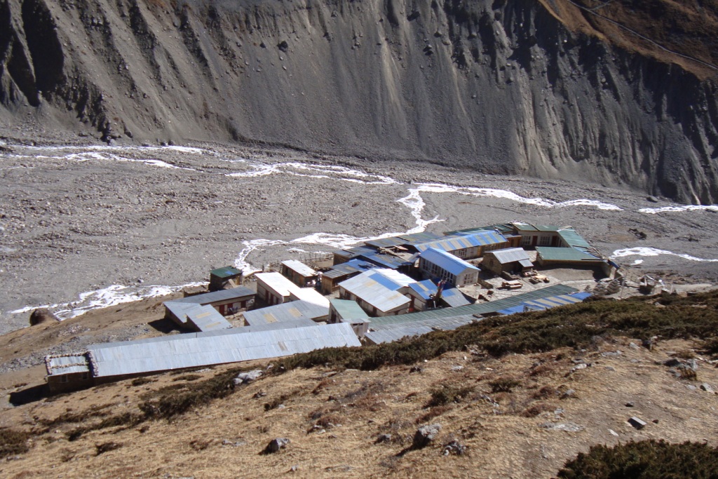
Photos gallery of Nar-phu vally trek :


Duration of trekking: 7-15 days
Group size: 2+
Day-1 Arrival to transfer Hotel
Day-2 Ktm Sightseeing .
Day-3 Ktm to Pokhara by bus 7 hours.
Day -4 Pokhara to Dhampus fedi by bus.
And same day Dhampus Pedi to Potana trek 3hours.
Day-5 Potana to Landruk trek 6 ours
Day-6 Landruk to Ghandruk trek5 hours.
Day-7 Ghandruk to Tadapani 6hours trek.
Day-8 Tadapani to Bhaisikharka or Dobato (local name Bayali kharka)_ 5 hours
Day-9 Bayali to Hidden lake trek Day trip . 10-12 hours (pack lunch)there are some seasonal tea house in Porne (3930m) but must of the time will be closed and we have contact when we will reach Bayali.
Day-10 Bailikhara to Shistibung 5 hours lunch camp.
Day-11 Shistibung to Khopra 4 hours trek lunch champ.
Day-12 Khopra to visit khayar lake hole day than back to Khopra or the Camp, duration 8 hours maximum altitude 5000m pack lunch,
Day-13 Khopra to Ghorepani trek 8 hours.
Day-14 Ghorepani to Hile trek 4 hours same day Hile to Pokhara by bus or continue walk to Nayapul and drive to Pokhara 42 km.
Day-15 Pokhara to Ktm by Flight.
Short Trekking itinerary :
Day-1 Drive to Kimche from Pokhara and trek to Tadapani (2650m). It takes 7 hours,
Day-2 Trek to Dobato (3350m) . It takes 5 hours,
Day-3 Trek to Porne (3930m). It takes 4 hours,
Day-4 Day trips to Hidden lake (4372m). It takes 7 hours,
Day-5 Trek to Tiribung (3425m).It takes 5-6 hours,
Day -6 Trek to Jhinu (hot spring-1780m). it takes 5 hours,
Day -7 Trek to Nayapul or Sewai and drive to Pokhara by private / public vehicle .


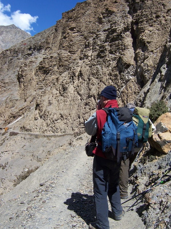
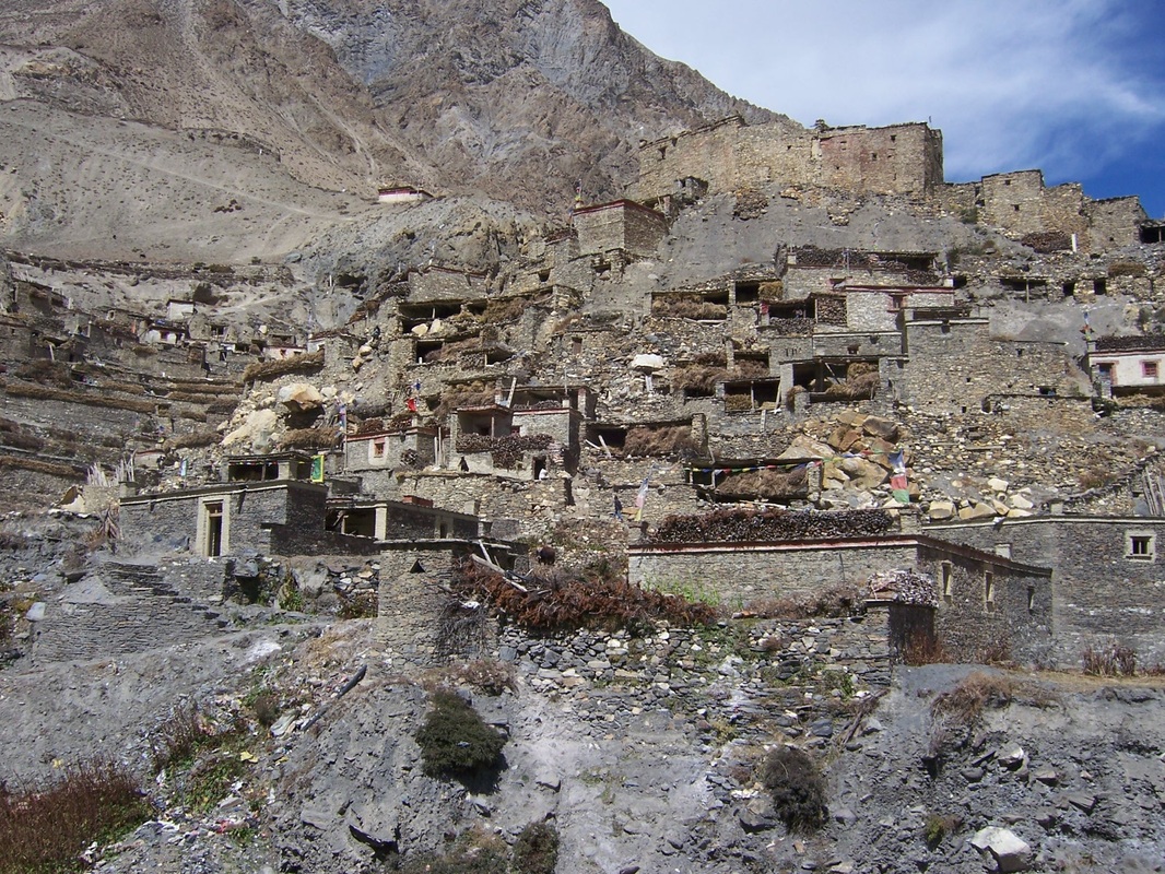
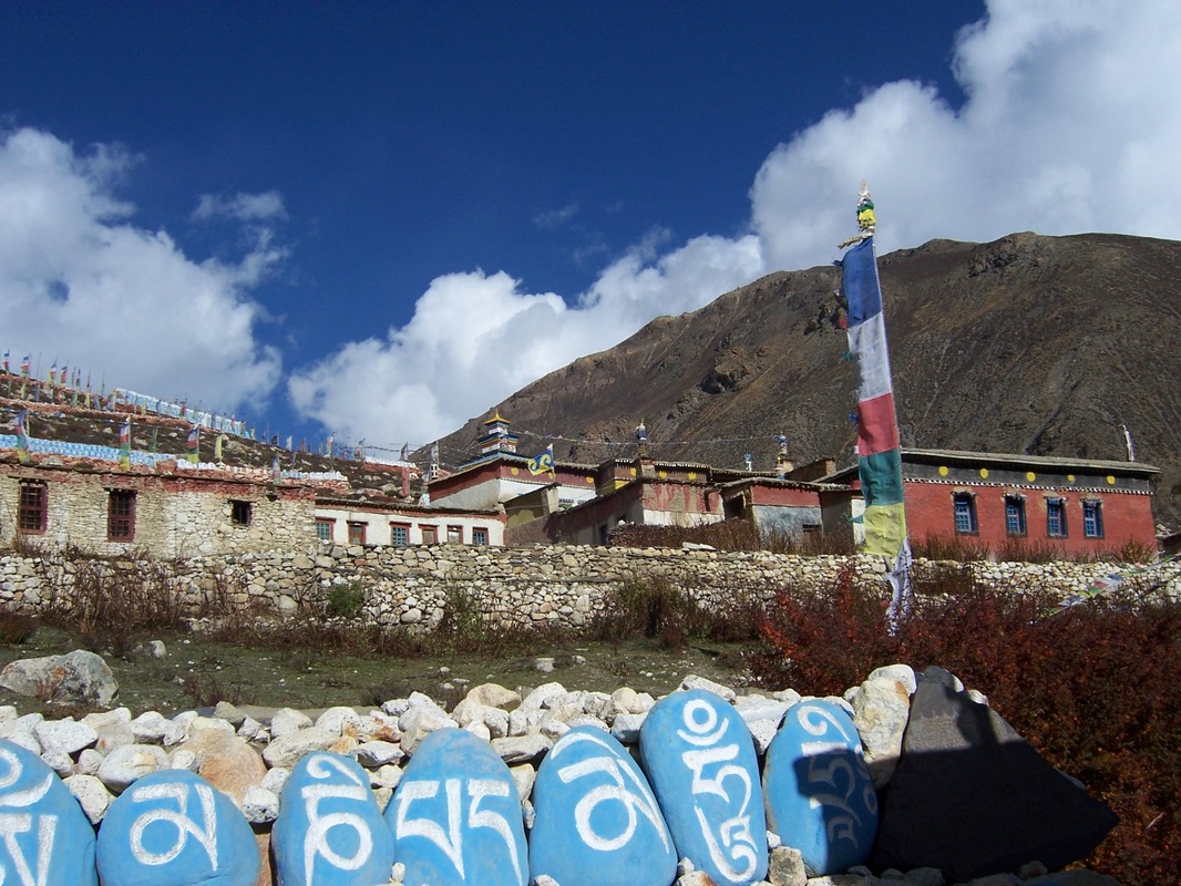
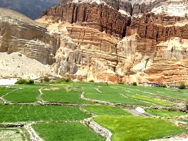
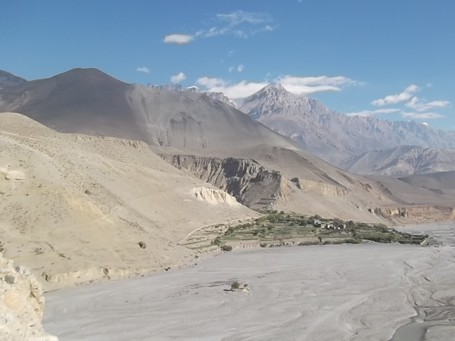
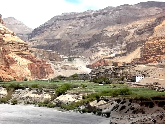
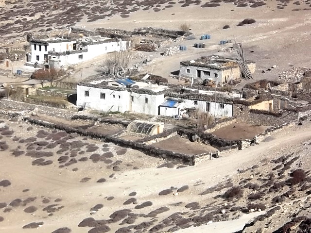
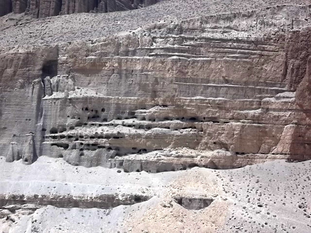
Upper mustang is an ancient Himalayan Kingdom which lies in the northern central part of Nepal and at the top of the Kaligandaki River. Upper Mustang consists of two distinct regions: the southern part and the northern where the languages, culture and traditions are alike to those of the Tibetan people. This area is consider as one of the most interesting and picturesque places in Nepal. The whole area has an isolated and mystical feel to it, enchanting and inspiring visitors to this region.
The trek to Lo- Manthang is through high altitude desert country climbing in and out of the huge sided valley of the Kali Gandaki. In places the gorgewhich the Kali Gandaki River runs through is the deepest in the world. This region is full of some of Nepal’s oldest Buddhist Monasteries, ancient and isolated villages with quaint white washed houses.
Facts of the Upper mustang trekking in nepal
Grade: Moderate to Strenuous
Best season: February, March, April, May, October, November
Per day walking: 5 – 6 hours
Type of Trek: Teahouse & Camping
Duration: 18 days
Maximum Elevation: 4320m
Explore the ancient Himalayan Kingdom:
# Interesting and picturesque places
# World Deepest gorge
# Buddhist monasteries
# Ancient and isolated village
# Unique culture and Tradition
Itinerary of Upper mustang trekking in Nepal:
(Please Note: If the Below schedule does not meet your need and interest, I can design individualized travel plans based on your preferences.)
Day 1: Kagbeni – Chele: 7 hours 2800 m - 3050 m 18 km.
Today we climbs quite steeply up into a jumble gullies and small towers, zigzagging to a viewpoint over Kagbeni with Nilgiri providing a dazzling white fluted back drop from the Kagbeni checkpost. The trail keeps to the east bank of Kali Gandaki River, climbing and descending. We lunch at Tange village the first village from Kagbeni to meet about 4 hours walk. It is also the Mongolian village where the all villagers are mixture of Gurung, Thakali and some families from the land of Lo. From Tanbe the trail again climbs to a high point around 3100 m. The trail then drops steeply and undulates along the east bank of Kali Gandaki for 1 ½ hours to the village of Chhuksang, from Chhuksang we can see the Chele. After a short walk along the river bank, there is a solid bridge across the Kali Gandaki at the point where it tunnels. Its way under a vast block of red sandstone, from here it is a short sharp climb to Chele 3 hours walk after lunch.
Day 2: Chele – Eklobhatte 6 hours 3050m - 3820 m.
The path climbs steeply up to a plateau region through a small tunnel like gully, climbing more. Gradually, the village of Ghyakar appears to the west as the path rounds a corner. The view South offers a panorama of Nilgiri, Tilicho peak and Yakawa Kang. The peak that dominates the Thorongla Pass on the Annapurna circuit. To the far-east the range of the Damodar Danda show peaks is visible. From the pass it is a short descent to Samar, a pleasant settlement in a grove of willows with good running water in irrigation channels. We get Samar village after 3 hours from Chele . It is the lunch place. After leaving Samar the trails dives steeply for about 70 m into a deep side canyon. Inevitably it is a short steep climb out and after a brief respite it dives again into another side canyon. This second climb is steeper and longer. After about 2 hours walk from Samar, the trail reaches 3750 m and descends slightly to the first tea house. The second tea houses can be seen in the distance, but once more the trails dives into another steep canyon and it will take a further hour to reach it. This place is known as EkloBhatte. This is our camping place.
Day 3: Eklo Bhatte – Ghami 6 hours 3520m.
From camp the trail climbs gently to a small pass at 3870m with views directly below into deep eroded canyons; which is one of the beautiful cave monasteries. About 1 1/4 hours from camp, is the tea shop of Syangmochen, another possible camp area. After gentle climb levels out to a Chorten (3700m. 2 hours) and the first view of Geling villages below (3500m). From here the path descends gradually into another less severe qully and climbs out to a collection of houses for lunch after 2 1/2 hours. Geling would be a good camping spot, with a monastery, Chorten and fairly extensive flat fields. From the lunch spot the trail continues round above Geling and starts the long climb to the Nyi pass at 3950m. A long descent, out of the wind, takes us down more steeply to Ghami 3520m. 11/2 hours from lunch.
Day 4: Ghami – Tsarang 6 hours 3520 m3500m 11 km.
From the Gompa in Ghami two tracks level down into a gully east of the village, one steeply past a trio of red, black and white Chortens that are a common sight in upper Mustang. At the bottom of the qully are two bridges across the river, there is a direct path to this point not visiting Ghami. The trail climbs onto a gently sloping plateau and passes beside a very long mani wall, about 1/2 hour, from Ghami , from the end of the wall, the trail heads east away from a very dramatic red eroded canyon wall towering above the village of Tramar in the distance, climbing steadily an altitude of 3770m is reached after about 2 hours from Ghami. The descent to Tsarang is mostly gentle and completed in a further 2 hours.
Day 5: Tsarang – Lo-Manthang 5 hours 3500 m - 3700m. 13 km.
The trail leaves Tsarang to the northwest and once clears of the village drops steeply into the Tsarang Chu canyon. After crossing the river, the route is initially very steep up a stony trach. As we round the corner and heads north , a fine view of the great white Himalayan peaks of Nilgiri, Tilicho and Annapurna I behind Brikuti peak is visible to the south east, the trail climbs gently along the west side of a side valley to an isolated chorten at 3620 m. 2 hours from Tsarang. A further hour takes us to 3700 m with some spectacular caves high up in the cliffs to the east. Having climbed to around 3850 m. a pass is reached and through a narrow ‘window ‘at the Summit the view ahead opens out to display the western valley of Lo-Manthang. The bright red and grey monastery of Namgyal sits on top of a pro monastery, with the wide valley surrounding Tingkar (the site of the King’s Summer palace) and Phewa villages behind Just down from the pass is the first dramatic view of the walled city of Lo-Manthang and the ancient ruined forts on the chills behind. There is a tremendous view to the east of the red, blue, grey, white and yellow eroded Mustang Khola canyon, to the north lie the flattish red colored hills and the Tibetan border. The western view is dominated by the snow-capped peak of ‘Manaslu‘. The descent to Lo-Manthang is short and after crossing the small river and climbing briefly the fabled city is finally reached.
Day 6: Acclimatization
Day 7: Lomanthang and eastern valleys, Nyphu, Ghaphu 5-6 hours round trip.
Day 8: Lomanthang and western valley, Namgyal, Tingkar 4 - 5 hours, round trip.
It takes around 2 hours to reach Namgyal Gompa which is situated at the hilltop serves as an important monastery of the local community and as local court. After visiting Namgyal gompa continues the tour to Tingkar, which is the village of around 400 houses, the laste main village to the north-west of Lo-Manthang.
Day 9: Lo-Manthang – Surkhang (3670m) / Yara Gang (Village) 4-5 hours.
From Lo-Manthang, the trail walks straight till Dhi pass (4100m) and descend down to Dhi village. Dhi village is one of the best village of Lo-Manthang regions. It seems more prospectuses and it is settled in a very suitable place. From then, the trail goes through river around 2 hours then reaches Surkhang.
Day 10: Surkhang - Lori Gumba (Monastery) – Yara Gang / 4-5 hours (4000m) and back to Surkhang.
Day 11: Surkhang – Tange Height - 3500 - 3240 m Time - 4 hours Distance - 10 km.
From Surkhang, we need to cross a river from Damodar Kunda one the sacred lake. There is no bridge on the Ghechang River, so we need to walk across the river in bare feet to cross this river. After crossing the river, the trail climbs up till high above a pass of 3850m, the trails goes through grasslands, treeless bare hill. After the pass the trail drops directly to Tange village at an elevation of 3240m. Tange is small village with around 30 houses but most of the houses are attached each other. On the roofs, one can see the piles of dry woods, which also reflect the prosperity in their society.
Day 12: Tange – Tetang Height - 3240 - 2940 m Time - 30 hours Distance - 10 km.
The trail walk through the deep ridge of hill providing the fine views of wind carved hills. Tetang village is formed between 2 hills as they should have found it as a safe place to avoid strong wind that hit the entire Kail Gandaki valley. Tetang is the upper village of Chuksang.
Day 13: Tetang –Kagbeni
Day 14: take the jeep to jomsom and again next transport to Tatopani(hotspring) or flight to pokhara
Day 15: From tatopani to pokhara by bus.


Khayar/ Khopra Lake Trek: About of Khayar trek, Guide for Khayar trek, About Khopra Loop trek,

trek we can visit Rhododendron forest.
Highlights
. A.D (Khayar Lake trek)
A= Means Annapurna Regions all mountains available to view.
D= Dhaulagiri-1 mountain also available to see from Khayar Lack.
• During Trek everywhere we can visit
Rhododendrons forest in Aprl/May Session.
Itinerary:Please Note: If the Below schedule does not meet your need and interest, I can design individualized travel plans based on your preferences.)
Day-1 Arrival to transfer Hotel
Day-2 Ktm Sidesheeng.
Day-3 Ktm to Pokhara by bus 7 hours.
Day -4 Pokhara to dhampus fedi by bus.
And same day dhampus fedi to Potana trek3hous.
Day-5 Potana to Landruk trek 6 ours
Day-6 Landruk to Ghandruk trek5 hours.
Day-7 Ghandruk to Tadapani 6hours trek.
Day-8 Tadapani to Bhaisikharka(local name Baili kharka_ 5 hours Note: Pack lunch
Day-9 Bailikhara to Shistibung 5 hours lunch camp.
Day-10 Shistibung to Khopra 4 hours trek lunch champ.
Day-11 Khopra to visit khayar lake hole day than back to khopra or the Camp, duration 8 hours maximum altitude 3500m pack lunch,
Day-12 Khopra to Ghorepani trek 8 hours.
Day-13 Ghorepani to Hile trek 4 hours same day Hile to Pokhara by bus 35km.
Day-14 Visit Pokhara.
Day-15 Pokhara to Ktm by Flight.
Photos gallery of Khayar trek:


Max.elevation : 4800m
Type of trek : Moderate
Duration of day :4-7days
Duration a day walking:3-6 hours
Mardi Himal trekking is one of the bitten Eco-tourism based trekking destination in Annapurna Himalaya region. Mardi Himal is the name given to the feature of the long rising ridge and its summit that from the southwesterly lower slope of Mount Machhapuchhare, the famous triangular skyline that is seen from the Phewa Lake at Pokhara. Mardi Himal is located in the east of the Modi Khola, across the valley from Hiunchuli. The emphasis of Mardi Himal trekking is on the forest and wilderness zone of these mountains. Mardi Himal trekking, follows the least trodden trail away from the trekkers madding crowd with and essence of exploration. We ascend through Hindu villages and pristine oak and rhododendron forest to alpine campsite that afford close up dramatic scenery of sacred Mt. Machapuchare, Mardi Himal and Annapurnas. The great ice fields and the blue glaciers of the Annapurana sanctuary walls lie below us. We descend from the different route to the warm valley and friendly villages on the bank of Mardi river still away from the used trekking routes. This Annapurna Camping treks designed to provide outstanding mountain profile and to venture into the forests and villages that have not felt the impact of tourism. Mardi Himal trekking offers superb Himalayan scenery including the Mt. Dhauglagiri 8167m, Mt. Annapurna 8091m,Annapurna II 7937m, Annapurna III 7555m, Annapurna IV 7525m, Annapurna south 7219m Hiunchuli 6441m, Fish tail/Machhapuchhare 6988m etc.Mardi Himal trekking is less touristy trekking trail in Annapurna region.Mardi Himal is considered to be an ideal introduction to trekking in the high Himalaya, particularly if you have limited time available. No previous experience of high altitudes is necessary, as every precaution will be taken to ensure gradual and thorough acclimatization during the trek to the mountain.Why to visit Mardi Himal trek?
• To get enjoy of the culture, nature, norms, hot hospitality.
• To get real peacefulness & real wilderness.
• To protect time & see many scenery of the other trekking route.
• Wildlife observation &dense rhododendron forest.• To see traditional agriculture, watermill, honey hunting, cattle farming(yak,
sheep, goat, cow, buffalo etc)
• Nepali traditional settlement.
Itinearay:
(Please Note: If the above schedule does not meet your need and interest, I can design individualized travel plans based on your preferences.)
Day 01: Drive to Phedi around 45 minutes and we climb 3 hours from Phedi steeply up to the main trail along the to Dhampus. The first nights camp at pothana 1650m.
Day 02: Pothana to forest camp ,
Dawn usually brings a spectacular sunrise with the fishtail tuning from pink to gold and the bare rock wall of annapurna II still in shadow. Now we start on the "secret trail" leaving tourist, other trekkers and the villages behind. We enter an enchanting forest of birch, giant rhododendron, mountain oak, maple, hemlock and daphnia. That evening we camp in a small cleaning at 255m far from the beaten trail.
Day 03:Forest camp to Low camp,
As we climb the flora changes into classic cloud forest with mosses and litchen, tree ferns andorchids. Now and then there are windows through the woods that look that ook out onto the thrilling panorama, towards Hiuchuli and the knife-sharp traverse towards Annapurna South. We can see the Mardi Khola vally leading up into the Annapurna Sanctuary. We stop climbing at lunch so as not to go too high too fast. The afternoon is as leisure, camped at 3400m and through the forest, we have mesmerizing views of the ever-closer Fishtail.
Day 4: Low camp to High camp ,
After just a short steep climb we are out of the forest, above the three-lone. A ridge, either grassy or under snow depending on the season, takes us up to our 'High camp', which we reach at lunch. We take another afternoon at leisure to acclimatize, at 4100m. The views here are awesome. Annapurna south seems close enough to throw a rock at while machhapuchare seems close enough to touch.
Day 05: Hight camp, explore around
Breakfast will be earlier than usual and with packed lunches, we set off to reach our objective .conditions being favorable we should reach up to 5,300m attain our absolute summit is never given. The great ice fields and blue glaciers of the sanctuary wall lie below and annapurna is beyond. In an area from horizon, from Dhaulagiri to the Ganesh Himal are a dozen or more Glistening snow-bound giants of the Himalaya. You are standing on a spot that has been your constant aim for days, a place a time a view that is almost impossible to equal and you have earned it! Whatever our achievement, by 1pm we need to descend back to 'High camp.
Day 06: High Camp to Siding Village
After a relaxed breakfast we make an unhurried descent down through the shade of the forest and out onto the terraced fields near the siding Village. We continue down to our camp at 1750m near the Mardi Khola .
Thew trail from siding now follows the contour of the river vally, gradually down between the pastures and through Tamang and Gurung villages at 1160m. With just a few hours of walking, we meet the road and our transport takes us Pokhara within a lunch time.


Why it is famous new trekking route:
Itinerary
Day 01: Drive Pokhara to Tatopani through Beni (6-7 Hrs) and Trek to Upper Narchyang (2 Hrs). Overnight at Upper Narchyang 2140m.(Homestay)
Day 02: Upper Narchyang to Chhotepa (7 Hrs-14km approx) through Lekhgaun, Ghalemdi, and Mristi Khola. Overnight at Chhoteopa 2370m.(Camping)
Day 03: Chhotepa to Sandhikharka (6-7Hrs-9km approx) through Humkhola. Overnight at Sandhikharka 3160m. (Camping)
(Please Note: If the Below schedule does not meet your need and interest, I can design individualized travel plans based on your preferences.)
contract: Tulasi Ram Paudel
Mail: tripnepal46@gmail.com / paudel588@gmail.com
websites:www.trekguidenepal.weebly.com
www.trekwithguide.blogspot.com
www.facebook.com/trekguidetulasi
Call or whatsApp:00977-9846058846
Tripadvisor: Professional freelancer trekking guide in Pokhara, Nepal
https://www.tripadvisor.com/Attraction_Review-g293891-d4722808-Reviews-Professional_Freelancer_Trekking_Guide-Pokhara_Gandaki_Zone_Western_Region.htm
Google: https://g.co/kgs/Gyg76PD
 |
| North Annapurna base camp trekking in Nepal |
No comments:
Post a Comment
Note: Only a member of this blog may post a comment.